iNavCalc VFR route planner 4.0.2
Free Version
Publisher Description
This app assists pilots in their VFR pre-flight navigation planning:
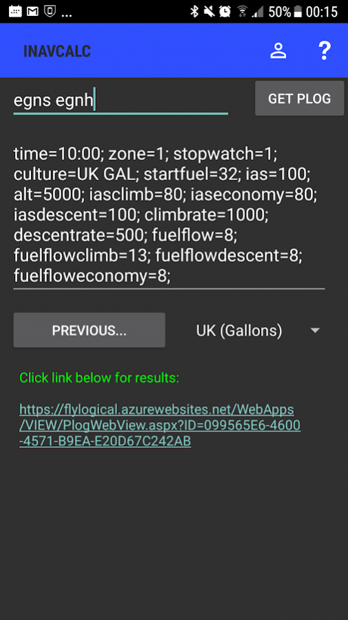
* Create your route by simply typing the list of desired waypoints
* Single click to generate your Pilot's LOG (PLOG) comprising all your navigation calculations for your route. Your PLOG, MET (METARS, TAFs), NOTAMS, and NAVCOM FREQUENCIES reports are made available via a file download page. The URL for this page can be shared (via email, social media, etc.)
* PLOG features:
-- drift uses the current MET to determine winds aloft for each waypoint along the route
-- magnetic heading uses a numerical geomagnetic model to calculate the magnetic deviation
-- altimetry (transition levels, flight levels, etc) and performance (density altitudes, freezing altitude, etc) calculations along the route
-- solar angle calculations (azimuth and zenith) along the route
-- includes fuel consumption profile along the route (including consideration of fuel consumption for initial climb-out, and any en route changes in altitude)
-- includes range and endurance estimation for possible diversion
* Specify wide range of parameters for the PLOG calculations including altitude profile along the route, airspeed profile along the route, date and time of departure (including UTC offset for local time), waypoint at which the stopwatch is zeroed (e.g., to enable PLOG times to be computed relative to a specified starting waypoint which can be different from the departure airfield).
* Save parameters & preferences for convenience and later re-use (requires free registration)
* Creates ".gpx" ".fpl" format files for easy import into other software tools and devices
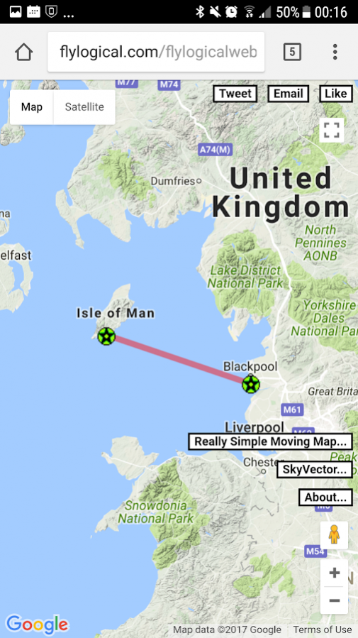
* View route in GoogleMaps, SkyVector, and FlyLogical's ReallySimpleMovingMap web app
This update is a complete rewrite of the app. It has been streamlined compared with earlier versions, and no longer requires registration with a FlyLogical user account (though registration is still supported and enables additional functionality such as accessing waypoints etc saved in the Cloud).
About iNavCalc VFR route planner
iNavCalc VFR route planner is a free app for Android published in the Geography list of apps, part of Education.
The company that develops iNavCalc VFR route planner is FlyLogical. The latest version released by its developer is 4.0.2.
To install iNavCalc VFR route planner on your Android device, just click the green Continue To App button above to start the installation process. The app is listed on our website since 2017-06-23 and was downloaded 23 times. We have already checked if the download link is safe, however for your own protection we recommend that you scan the downloaded app with your antivirus. Your antivirus may detect the iNavCalc VFR route planner as malware as malware if the download link to com.flylogical.inavcalc is broken.
How to install iNavCalc VFR route planner on your Android device:
- Click on the Continue To App button on our website. This will redirect you to Google Play.
- Once the iNavCalc VFR route planner is shown in the Google Play listing of your Android device, you can start its download and installation. Tap on the Install button located below the search bar and to the right of the app icon.
- A pop-up window with the permissions required by iNavCalc VFR route planner will be shown. Click on Accept to continue the process.
- iNavCalc VFR route planner will be downloaded onto your device, displaying a progress. Once the download completes, the installation will start and you'll get a notification after the installation is finished.
